Cheviot Goat Recce
What is the Cheviot Goat?
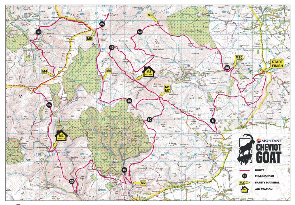
A 55-mile loop of the largest of the Cheviot hills on the English-Scottish border in Northumberland. This is the least populated of all the national parks in the UK and the terrain is beautifully bleak with only low lying heathland showing the skeleton of the hills below (see map underneath for route)
The race is run in December at the peak of winter. It has a reputation for being one of the hardest UK ultras due to its’ remoteness and lack of aid stations. It is named after the Cheviot Goat, a hardy and wild goat that thrives on these hills. I had wanted to run this race for a while but felt like my navigation skills still needed work.

The Plan
Despite living in the North East I have never explored the Cheviot Hills and given a potential move back to Newcastle I wanted to suss them out. I had a few days gap whilst my partner was still at work before we both met my parents on the Northumberland coast for a weekend break. The stars aligned. A perfect opportunity for a solo fastpack and recce!
Although recce-ing the Cheviot Goat route, I certainly wouldn’t be preparing for the weather with a heat wave forecast and temperatures over 30°C. Not ideal but another challenge.
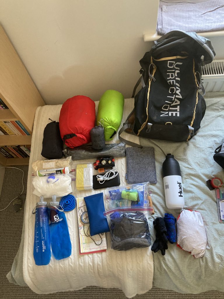
Kit
Sleeping
- Tent – Z packs duplex
- Sleeping bag – OMM Mountain Raid 160 Sleeping Bag XL
- Mat – Thermarest neoair uberlite
Food and drink
- Salomon filter soft flasks
- A few snacks + huel + tailwind powder
- Compact funnel
Clothes
- Montane minimus jacket
- Salomon gloves
- Montane allez micro fleece hoodie
- Montane prism jacket
- Buff, leggings, WP trousers, microfibre towel
Other
- Garmin in reach mini
- 10,000 mAh battery bank
- Fenix HM65R-T head torch
- Ultimate direction 25l fastpack
- Hoka Torrent 2 shoes
- Kindle
Total weight = 6.8 kg with 2 days food and 1L water

Day 1
Distance – 56km
I started in Ingram at sunrise to try and make as much progress before the heat became too much. It was a beautiful run from the get go. Vast views out to the coast behind me and looming hills in front of me. The skies were completely clear and it soon began to warm up. I was only carrying 1 litre of water with me and was intending to refill using my Salomon soft flasks with filter at the many streams that were visible when planning the route on OS maps. Given the preceding week long heat wave I was nervous that these streams may be dry and I would be without water and also unable to dissolve my tailwind + huel. If this was the case then I would reevaluate the route and descend to one of the larger streams / rivers until I found water.
My 1 litre of water lasted the first 16km until the Cheviot. None of the streams materialised but I found a large bog / puddle on the top of the Cheviot where I paused to drink an extra litre of water and then refill to full. The next water stop wasn’t for 22km, the heat was building and there was no shade in sight on the hills and rather disconcertingly I spent a good chunk of the day running towards a wildfire on the heathland. Eventually the River Coquet provided some much needed cool water and the cover of a lone tree. I had a short snooze before carrying on until the campsite for the night.
[osmap gpx =”https://fastpackuk.co.uk/wp-content/uploads/2022/12/20221209091935-09154-data.gpx” profile=”175″ markers=”NT91960909;Camp|NU01731632;Start/Finish”]
Night 1
56km to the campsite took me about 8 hours and by the time I arrived I was feeling pretty wrecked. I managed to rehydrate slightly but then felt too nauseated for much food or to relax and read a book as intended. This lasted for a good few hours and I just lay down and waited for it to pass, thinking that it was likely the result of heat + dehydration. Despite this, I managed to sleep extremely well and in complete comfort with my new mat and sleeping bag. I set off on day 2 feeling good but aware that I may need to shorten the route if I suffered the same water finding difficulties. Soon enough this became reality and I decided to shorten day 2 to around 20 km.
Day 2
Distance – 20km
I set off on day 2 feeling good but aware that I may need to shorten the route if I suffered the same water finding difficulties. Soon enough this became reality and I decided to shorten day 2 to around 20 km. On finishing in Ingram there was a whole host of families out sunbathing and swimming in the river. I decided to join them to cool down and lay submerged for 20 minutes before I was completely cooled down. I treated myself to a sandwhich and orange juice at the stunning Ingram cafe and then drank 4 litres of iced water before passing any urine which was slightly concerning.
Overall, it was a successful recce and opportunity to hone my fastpacking setup and running nutrition. It was difficult going with the heat and lack of water but this was also good practice. I discovered some great new hills, although the landscape was a little desolate and ‘martian’ for my personal taste and could do with a few more trees to break up the heathland.
Lessons learnt
- Tailwind and huel worked great for nutrition and were much lighter than solid food. Stove and propane canister were not missed.
- Smaller pack size meant I suffered no issues with chafe
- Much better night sleep with new sleeping setup. Having a good mattress meant I could actually sleep. I don’t think I will ever be one of those runners who can sleep with a slither of foam mat just under their hips.
- Can go far on little water if required but will feel the consequences at some point so there must be options to adjust the route if required. I should also carry extra bottles if needing to have more than 1 litre water at a time.
